
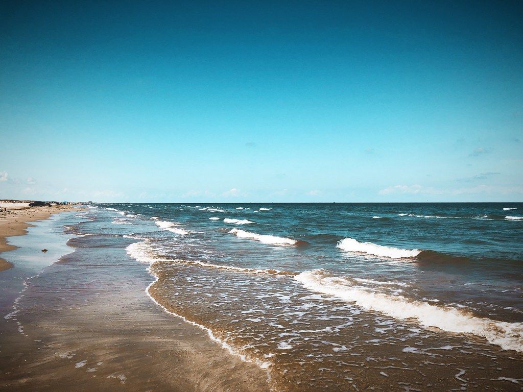
Mustang Island is a long, narrow barrier island between the Gulf of Mexico and Corpus Christi Bay. Port Aransas occupies its northern end, and much of the rest is lined with houses and condominiums. But a few miles south of town, Mustang Island State Park keeps a long stretch of the island largely as it was: wide sand, tall dunes, sea oats and open sky.
It is the closest true Gulf beach to Rockport that feels wild, and on a quiet weekday out of season, you can walk for a long time without meeting anyone.
Ferry or causeway
From Rockport, the quickest route is south to Aransas Pass, across the causeway to the ferry, over the channel to Port Aransas, and then south on Highway 361 down the island. Ferry waits vary a great deal, from a few minutes on a quiet morning to an hour or more on a summer weekend. The guide to Port Aransas and the ferry across the channel covers the crossing in detail.
The alternative is to drive through Corpus Christi and across the causeway onto Padre Island, then north to the park. It takes longer on the road but avoids the ferry, and it suits people towing a trailer or driving a large vehicle.
The park charges a daily entry fee per person, and state park passes cover it. Fees and rules get revised, so look them up the week you travel.
The beach
The park's Gulf beach runs for several miles, broad and flat, with fine pale sand. The water is often a clear green on calm days and brown and choppy when the wind is up. Shells, driftwood and sea beans wash up along the tide line.
Driving on the beach is part of life on the Texas coast, and in parts of the park you can drive and park on the sand. The rules on where you can drive, where you can park and how fast you may go are set by the park and can change. Stay on the hard-packed sand near the water, keep off the dunes, and watch for people, birds and soft spots. A four-wheel-drive vehicle is not always necessary, but soft sand can trap ordinary cars, especially after high tides.
Down the road · IslandsPadre Island National Seashore and the sea turtlesThe dunes
Behind the beach, the dunes rise in a long, uneven ridge, held in place by sea oats, morning glory and other tough plants. They are the island's first defence against storms, absorbing waves and wind that would otherwise wash over the land.
Walking or driving on the dunes damages the plants that hold them together, and it is not allowed. Use the marked paths and boardwalks to cross from the parking areas to the beach. The plants look wiry and dry, but they are vital, and once lost they take years to recover.
Look for ghost crabs scuttling across the sand near the dunes, especially in the early morning and evening. Sanderlings and willets run along the waterline, and brown pelicans glide low over the waves.
The paddling trail
On the bay side of the island, away from the surf, the park has a paddling trail through the shallow waters of Corpus Christi Bay. Marked routes wind through seagrass flats, marsh and small islands, and the water is usually calm and only a few feet deep.
It is a peaceful way to see a different side of the island. Fish dart through the seagrass, wading birds stalk the shallows, and on a still morning the only sound is your paddle. Wind is the main challenge. A strong breeze can make the return trip hard work, so plan to paddle into the wind first.
Bring your own kayak or canoe, along with water, sun protection and a way to call for help. The park can give current information on the routes.
Rip currents, jellyfish and heat
Rip currents are the biggest danger on this beach. They are fast, narrow channels of water flowing away from the shore, and they can carry even strong swimmers out quickly. They form most often near piers, jetties and gaps in sandbars, and when waves build. If you are caught in one, do not fight it. Swim parallel to the shore until you are free, then swim back in.
Jellyfish and Portuguese man o' war are common at certain times of year, especially after onshore winds. Their stings are painful, and the man o' war can sting even when washed up on the sand. Do not touch them. Vinegar can help with some jellyfish stings; for severe reactions, get medical help.
The sun is strong and the beach has almost no natural shade. Bring an umbrella or shelter, wear a hat, and drink often. In summer, plan your time on the sand for the morning or late afternoon.
In storm season, from June to November, follow official forecasts and leave the island early if an evacuation is ordered.
Camping on the island
The park has camping areas, from simple sites on the beach to sites with water and electricity near the park headquarters. Beach camping puts you right beside the surf, with the sound of the waves all night, but it is exposed to wind, sun and the occasional high tide. Reserve ahead for busy periods.
From the park, the island road continues south onto Padre Island, where the national seashore keeps an even longer stretch of beach undeveloped. The guide to Padre Island National Seashore and the sea turtles covers it. For a quieter, sheltered bay beach closer to Rockport, the guide to Rockport's harbour, beach and art galleries is a good contrast.
Picture credits: joncutrer – Creative Commons BY 2.0.